Woke up to the most spectacularly clear day imaginable – could see perhaps 50 or 60 miles across the gravel flats below. We had to make the most of this, so we drove straight to “Skaftafell Airport” (one hut, one gravel runway, one plane, one man!).
Twenty minutes later, we were bumping down the runway in our chartered Cessna (high wings, much better for photography) – just myself, Miss C and our pilot.
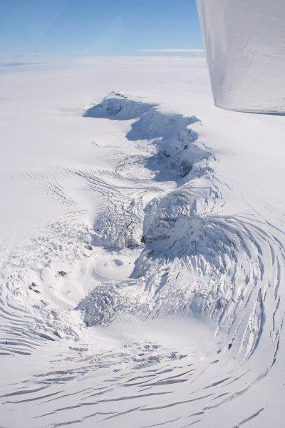
Up, up and away – we flew east, past craggy mountains with the shining sea on our right, back to Jokulsarlon, which we circled slowly, able at last to see the full extent of the lake and the glacier which feeds in. Then, we turned north and flew into the heart of the great icesheet, Vatnajokull. Our goal was Grimsvotn, a multi-cratered volcano which lies buried beneath hundreds of metres of ice. It did not disappoint – huge concentric circles of crevasses and wisps of escaping steam betrayed the vast heat that was devouring the ice from beneath. See below, the craters of Grimsvotn below our wingtip as we approached from the south...
The sights did not stop with Grimsvotn – having climbed to a great height to reach the centre of the icesheet, the incredibly clear air allowed us to see incredible distances – as far west as Hekla. From checking the views against a map after the flight, I believe we could see about 1/3 of the entire country. At this point, we were flying over a vast and almost featureless expanse of white, below an almost cloudless sky – at our deepest penetration into the ice field, we might as well have been in Antarctica. Not a tree, house or road or any liquid water. In fact, the land itself was almost invisible, with only a very few rocky summits piercing the surface – this must be what the ice ages were like.
Returning to the coast, we passed over a mountain which had a very unusual feature: huge icebergs marooned on a vast mud beach around its shores. Our pilot told us that just one month previously, the water level had been much higher – so much so that the pressure burst a temporary channel down to the sea, the rapid change depth leaving the icebergs stranded.

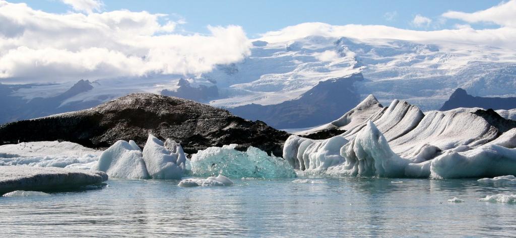
Post flight, we returned to Jokulsarlon by road for more photographs and a boat trip (not cheap, but recommended). The stunning weather made for much easier photography – see below, another of Miss C’s pictures.
No comments:
Post a Comment